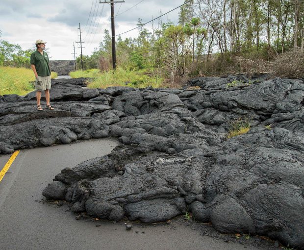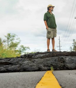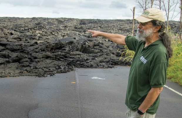
Jim Kauahikaua ’73 stands on one of a series of lava flows blocking a highway just south of Pāhoa, on the Big Island of Hawaii.
The eruptions on the island of Hawai‘i—better known as “the Big Island”—are a few weeks old, and it’s becoming clearer by the day that this time is different. Bigger. Less predictable. More explosive. At a press update at the Civil Defense office in Hilo, a tall man with a tangle of gray-white beard and a baseball cap turned backward steps in front of the cameras and introduces himself in a soft, gravelly voice.
 “Jim Kauahikaua, U.S. Geological Survey’s Hawaiian Volcano Observatory. I’ll do a quick summary of what’s happening. Vents eight and 16 have reactivated. Twenty-two and 13 are still the main southbound channels going into the two ocean entries, though those have been quite weak today …”
His tone is quiet, his words measured—full of unembellished facts. His answers to questions are patient. If his eyes roll just a bit at some of the uninformed queries from mainland reporters, you can’t see it through his sun-darkened glasses.
His colleague Tina Neal, who succeeded him four years ago as the observatory’s scientist-in-charge, calls this “the voice of the consummate scientist.” And even as repeated explosions rock the volcano’s summit in the days ahead, launching vast columns of ash miles into the sky, that imperturbable baritone, explaining each day’s events, will remain strangely reassuring.
Born on O‘ahu and raised amid the volcanic starkness and splendor of the islands, Jim Kauahikaua ’73 has been studying the volcano known as Kīlauea for most of his life. The first native Hawaiian to serve as scientist-in-charge at the volcano observatory, he is one of a handful of people who can claim both a deep scientific understanding of the world’s most active volcano and a rich and intimate knowledge of its history.
While earning his doctorate at the University of Hawai‘i in Mānoa and throughout the early part of his career as a geophysicist, he probed the volcano’s subterranean secrets with scientific instruments, studying—among other things—the way lava tubes form. More recently, he has worked on assessing hazards and reconstructing the volcano’s past through vintage news accounts, many of them taken from now-defunct Hawaiian-language newspapers that have never before been translated.
As a result, he wasn’t completely surprised by the sudden violence of the 2018 eruptions. It simply reminded him of events from long ago. It’s the kind of connection he’s always on the lookout for as he searches for patterns from the past that can help explain how the volcano is evolving today and predict what it might do tomorrow. “We’ve known for some time that Kīlauea has had explosive phases,” he explains. “The most recent one killed at least 80 Hawaiian warriors at the summit.”
Sagehens vs. the Volcano
Jim Kauahikaua ’73, who served as scientist-in-charge at the Hawaiian Volcano Observatory from 2004 to 2015, wasn’t the first Pomona alumnus to serve in that role. In fact, Sagehen geologists have dominated the post in recent years, holding it for about 20 of the past 44 years. Long before Kauahikaua’s term, there was Bob Tilling ’58, who served from 1975 to 1976. While he was there, Tilling introduced his old geology classmate, Tom Wright ’57, to the volcano, and a few years later in 1984, Wright was appointed scientist-in-charge, serving until 1991.
What he’s referring to is an event that happened in 1790, the final stage of several centuries of explosive summit eruptions that inspired one of the great Hawaiian sagas about the goddess Pele. Many years later, a geologist named Don Swanson connected the folkloric and scientific dots to recreate a vivid picture of what happened near the summit that day.
“Hawaiians had no written language prior to contact with the Western world, so we only know about it through oral traditions,” Kauahikaua explains. “We don’t know how many explosions there were or how strong they were, but we do know that the explosion cloud for one of them was viewed from the other side of the island, so it was visible above the summit of Mauna Loa. That means it was big—a 20,000- or 30,000-foot-high explosive column.”
He even has a good idea about how those 80 warriors may have died. They were probably the victims of what’s known today as a base surge.
“In an explosion, a lot of material is thrown up into the air,” he explains. “The very fine stuff drifts off in the atmosphere and can travel 100 miles or more. But the larger, coarser stuff will just fall right back down, and it falls down as sort of a superheated, gas-charged mass. So it doesn’t just fall and hit the ground. It falls and starts to travel very fast horizontally. That’s a base surge, and those warriors were caught in it.”
For Kauahikaua, Swanson’s work is a model for the kind of pattern-seeking research he’s engaged in today. “Our primary way of trying to forecast what is going to happen in the future is by knowing in detail what has happened in the past,” he says.
These days he’s focusing primarily on the 19th century, a period that he believes still has a lot to offer in understanding the cycles of activity that Kīlauea has passed through.
“I’ve mostly been concentrating on large lava flow eruptions,” he says. “One thing I’ve found is that they all kind of exhibit the same behavior the last couple of months of their existence, and that is that they start to stall and then pulse forward and then stall again. So it’s sort of a pulsating, rather than a steady advance.”
He found that pattern in eruptions in the 1881 event, when a lava flow from Mauna Loa was advancing on what is now the city of Hilo. And he found it again in eyewitness accounts of another Mauna Loa eruption that again threatened Hilo in 1935.
And he saw the same thing near the end of the 2018 eruptions at Kīlauea.
During these most recent eruptions, Kauahikaua found himself right in the middle of the action but, at the same time, frustratingly far from the front lines.
As the observatory’s liaison with the island’s emergency operations center, he saw very little of the historic eruptions with his own eyes. “I was at Civil Defense virtually through the entire thing,” he recalls. “I think I did about a half dozen of the overflights out there, and I was only on the ground twice.”
And yet, every significant piece of information reported back by the teams of observers who were patrolling the rift zone each day passed through his hands as he updated representatives from all relevant organizations—from utility companies to the National Guard—keeping them informed about unfolding events and the resulting hazards that might be facing them that day.
From the first, Kauahikaua says, the public demand for information was “crazy.” But just getting reports from the field was often a struggle. Some of the cell towers in the area had burned down, making cell phone reception spotty. And some members of the teams were novices who had to learn on the job how to make a clear report.
Another problem, Kauahikaua says, was the role of social media, which was handled by USGS geologists thousands of miles away on the mainland. “We were prepared for regular media with conference calls and information releases via email and our website,” he explains. “But social media added a whole new set of demands, sometimes seemingly favoring quickness over quality of information. And anything but quality information would defeat our mission.”
 But the main thing that Kauahikaua says tried his patience during those long weeks was the bureaucratic conceit of some of the early incident management teams sent in by the Federal Emergency Management Agency (FEMA), which used the emergency as a training exercise. “None of them had Hawai‘i experience or eruption experience, so—for example, safety out in the field. All of a sudden, we had these people from God knows where, Georgia maybe, telling us what was safe and what was not safe. And that rubbed a lot of people the wrong way.”
The 2018 Eruptions by the Numbers
˜1 BILLION CUBIC YARDS OF LAVA ERUPTED
13.7 SQUARE MILES OF LAND INUNDATED BY LAVA
875 ACRES OF NEW LAND CREATED BY OCEAN ENTRIES
716 DWELLINGS DESTROYED BY LAVA
˜30 MILES OF ROAD COVERED BY LAVA
˜60,000 EARTHQUAKES (APRIL 30–AUGUST 4, 2018)
6.9 MAGNITUDE OF THE STRONGEST QUAKE
Another Hilo resident who was quickly drafted to lead one of the teams on the ground, Professor Emeritus of Geology Rick Hazlett, seconds that opinion: “I’ll tell you that they didn’t know volcanic gas from a hole in Kansas. It was disgraceful, I thought.”
However, he believes Kauahikaua was the perfect choice to deal with all of those complicated communication issues. “He’s very exact about the certainty and clarity of detail,” Hazlett says. “So he’s a good filter in terms of making sure that he got good information. The last thing he’d want to do was spread a falsehood. Secondly, he speaks with calm equanimity, irrespective of how he’s feeling inside. And thirdly, he’s a voice that is trusted in this community, because he is Hawaiian, and he’s been here throughout his postgraduate career. He’s not passing through.”
That’s actually an understatement. Hawai‘i is not just Kauahikaua’s home—it’s pretty much the full range and scope of his professional interests and ambitions. “Many of my colleagues are interested in volcanoes, period,” he says. “There is this type, and there is that type. I can honestly say that I am way more interested in our volcanoes than in any other volcanoes.”
Part of that, he admits, is a love of the cultural side of the phenomenon. Native Hawaiians have had a complex and intimate relationship with their volcanoes for centuries and continue to relate to them in ways that outsiders have trouble understanding.
“As a matter of fact,” he says, “you can see this in the most recent event, where lava threatened people’s homes, and native Hawaiians would take the attitude, ‘Pele is related to us. She is in our family tree.’ So they would actually see it as if a relative were visiting, which made me think, ‘That is a very clear understanding of our place on this landscape.’ If you feel that you own a piece of land, it is kind of temporary.”
For Kauahikaua, that sense that everything is temporary isn’t just academic. Indeed, he considers every day that he is able to study the volcano that he loves to be a gift—one he almost lost 15 years ago when he began to have blinding headaches and double vision and was eventually diagnosed with stage-four nasopharyngeal cancer, a tumor just below his brain.
For the better part of a year, he and his wife, Jeri Gertz, moved to Honolulu, where an oncologist put him through more than 40 radiation treatments and five or six chemo treatments. “He said he was going to nearly kill me to cure me, and that’s how it was,” he recalls.
The treatment left him with one deaf ear, significant hearing loss in the other and an enhanced appreciation of his opportunity to keep doing the things he loves. “There are gifts inside the most difficult of challenges,” Gertz says, “and both Jim and I would agree that we found those gifts.”
Asked about retirement, Kauahikaua said he thinks about it often, especially now. The observatory’s offices at Kīlauea were so badly damaged by earthquakes that the organization has had to scatter its personnel among crowded, makeshift office spaces around Hilo—a situation that he finds less than appealing. But he’s not ready to retire just yet.
In any case, Gertz says she doesn’t think retirement would be a change of direction for her husband—just a change of employment. “He will always continue to be this man who studies volcanoes, whether he’s employed with the USGS or not,” she says.
The latest eruptions started at the end of May and petered out near the end of August. They left behind a changed island—not only in a portion of its topography but also in its expectations. As Kauahikaua likes to say, “Our volcano isn’t the type you run away from. It’s the type you run toward.”
He means that literally—Hawaiian volcanoes have enjoyed such a reputation for tameness over the years that they’ve actually been draws for millions of visitors. In fact, he explains, “the activity at Kīlauea was the initial attraction for tourists in the 19th century and the location of the first hotel in the kingdom.”
Indeed, in this idyllic Hawaiian setting, even something as powerful and potentially dangerous as a thousand-foot-high lava fountain can somehow end up seeming harmless, as happened at Kīlauea in 1959. The fountain was right at the edge of a long crater, he recalls. “And so if the winds were right, the winds would blow the fountain debris away from the viewing areas, and any lava produced would fill up this crater. So it was a perfect thing for viewing. It became known as the ‘drive-in volcano.’”
Today, people still come to Hawai‘i to see lava flows and fountains or to watch glowing streams of molten rock slide into the ocean amid roiling clouds of steam—as if it were all a show put on for their entertainment. “Even during this past summer’s explosions and collapses at the summit, there were a few that wanted to see the summit area,” he says. “Several were arrested or cited by the National Park Service.”
But all of those years of constant but fairly predictable activity—more effusive than explosive, in a volcanologist’s terms—might at last be coming to an end. Certainly, the 2018 eruptions seemed to break the mold in a big way—or maybe it would be better to say that they turned back the clock. “Basically, it erupted 10 years of Kīlauea lava in three months,” Kauahikaua says. And it did so with a violence that the island hadn’t seen in centuries.
One good thing he thinks might come out of it is a greater acceptance among island officials of the unavoidable dangers of development in a rift zone, something the scientists at the observatory have been preaching about—largely in vain—for decades. The destruction of more than 700 homes over a three-month period, he says, may have finally changed some political hearts and minds. At least he hopes so.
After all, living in close proximity to one of the most powerful and unpredictable forces on earth calls for a certain degree of humility.
As Kauahikaua says, “Volcanoes were here first.”
