
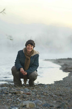
The morning sun has only begun to tint the sky when Heather Williams breaks through thin shrubs to reach the gravelly bank of the Santa Ana River, which is running cool, clear and fast. Williams has come here often over the past two years, mainly as part of her academic research, but also because she finds the site enchanting at the break of day.
 She also is drawn by the juxtaposition. Egrets, ducks and other birds wing above as unseen creatures rustle in the dry grass, a bucolic backdrop to the homeless people sleeping in tents deep in the brush, and the distant rush of commuters barreling down unseen roadways. The air carries a tinge of burning garbage as well, from breakfast campfires near the covered-over Tequesquite Landfill that Williams walked past to get here.
“This is here, this is accessible to us, even when we think that we are surrounded by nothing more than big box stores and concrete and freeways and noise,” says Williams, a professor of politics who teaches, among other courses, Global Politics of Food and Agriculture. “For me it’s a metaphor for our ability to access nature in unexpected places. And it presents us with a choice for the future.”
For all the natural beauty of this stretch of river, the spot Williams has picked out cuts through suburban neighborhoods three miles southwest of downtown Riverside. The Santa Ana, surprisingly, is the largest river in Southern California, traveling nearly 100 miles from its source on Mount San Gorgonio through the Inland Empire and Santa Ana Canyon—where the 91 Freeway cuts through the mountains to Orange County—and on through to the Pacific at the Newport Beach-Huntington Beach border.
This geography represents past and future, and the centrality of water to human settlement—people have lived along the waterway for 9,000 years. And it is the subject of Williams’ book-in progress, River Underground: The Secret Life of the Santa Ana, which looks at the modern evolution of the river from early flood-control efforts through its present condition, amid the region’s expanding population and conflicting demands.
It’s a convoluted past for this inconsistent ribbon of water. The Santa Ana has raged in massive floods and all but disappeared in droughts. It has had its riverbed paved in sections. And it has been the focus of political battles over who gets to use its water, how it should be managed and the role it plays in regional recreation.
In fact, there are scores of free access points along the river, from the foothills of the San Bernardino Mountains to Williams’ favorite spot here amid the cottonwoods to where the Santa Ana reaches Orange County’s emblematic beaches. More than 40 miles of developed hiking and biking trails along its length offer oases of nature—and a glimpse of the original landscape—amid the SoCal sprawl.
Oddly, Williams was drawn to studying the Santa Ana River through a research project she did in Peru on the political overlays to human migration and boundaries, both natural and national. But the local Peruvians wanted to discuss water quality and mechanisms to collect statistical portraits of the health of local rivers.
That started an evolution of thought that led Williams to wonder about the health and history of her local watershed, and the demands that will shape its future.
For Williams, this spot along the river represents what has become a consuming area of academic inquiry and a place to generate and share ideas, as she did last summer with a “dream team” of summer research assistants, including Tara Krishna ’14, Clare Anderson ’15 and Minerva Jimenez, Cal State Fullerton ’14. But it also has become a temporary refuge, a place where, on a spring day, “you would see the willows in all their glory. And you would hear the wind coming through the cottonwoods.”